Trip Report: Gabbot Pass & Lake Italy
One of the best things about Vermilion Valley Resort is just how deeply embedded it is into the backcountry. Famously, this works in favor of PCT/JMT thru-hikers, who can resupply with only a couple miles of additional walking, but it also benefits anyone planning a backpacking trip out of VVR; within two days' walk there are countless basins, passes, and alpine lakes to explore, and the trailhead permits are typically plentiful.
As an avid backpacker, I've done my share of exploration in this area. Graveyard and Mono Passes are memorable trips. But for years I'd looked east across Lake Thomas Edison and wondered what lay in the high country beyond Recess Peak and the Volcanic Knob. This year, with a group totaling eleven friends from the Los Angeles area, I was able to find out!
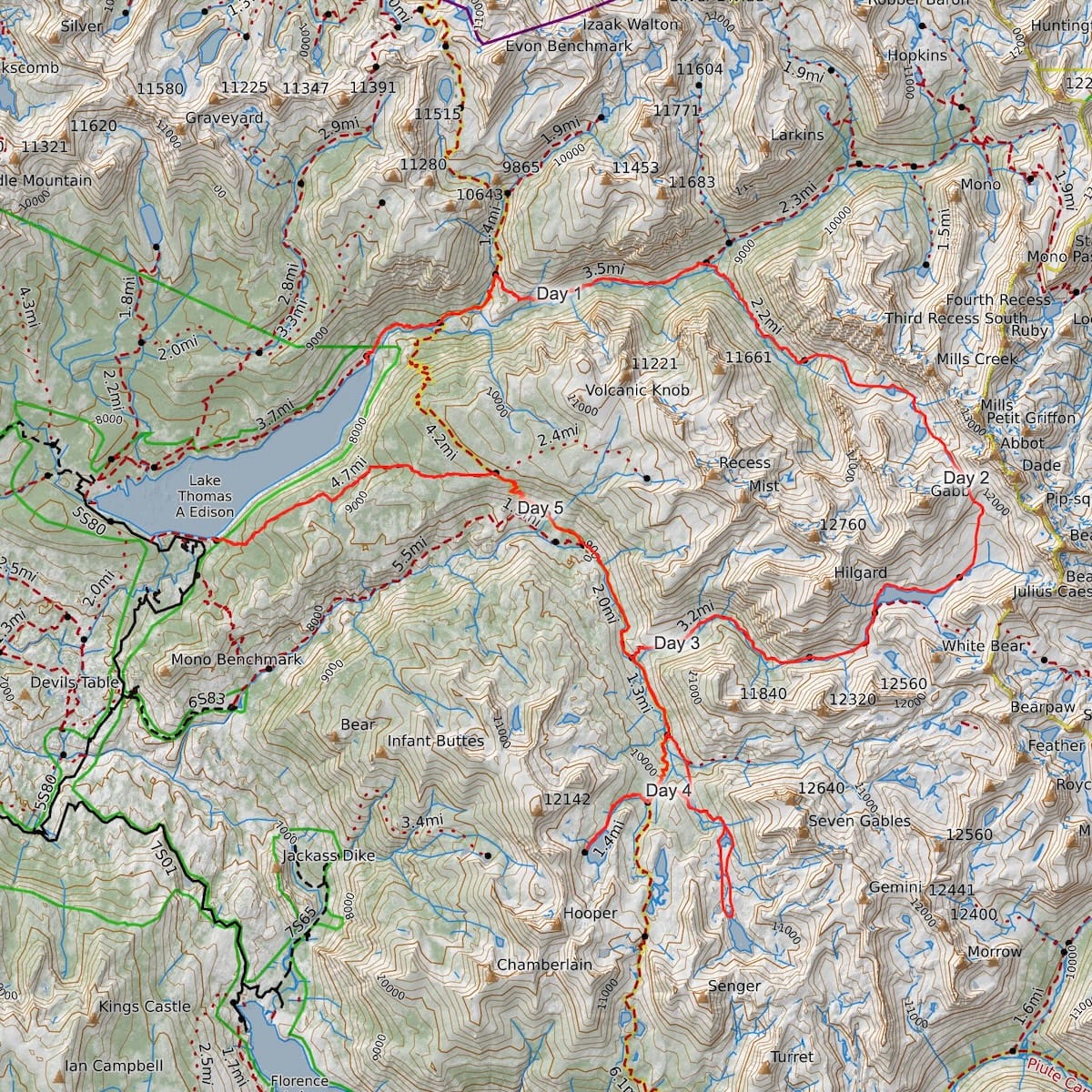
The big idea was to go up the Second Recess and over Gabbot Pass, camp near Lake Italy and then rejoin the JMT/PCT following the Hilgard Branch of Bear Creek. After this mostly off-trail portion, we'd stick to established trails and explore the side-basins and lakes just north of Selden Pass. Above is a map of our ~45 mile journey, also available on CalTopo.
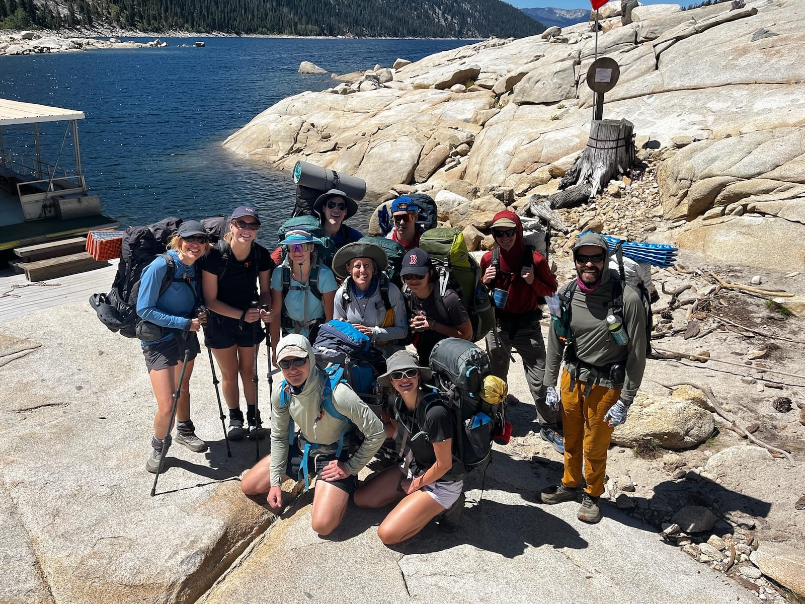
Day 1: Ferry to Mills Creek
~8 miles, +2,000', -500'
We started our trip with a ride on the VVR ferry, and promptly began hiking up the Mono Creek drainage. I'm always impressed by the size and grandeur of this watershed, but it makes sense given the amount of water that pours into Edison Lake every year.
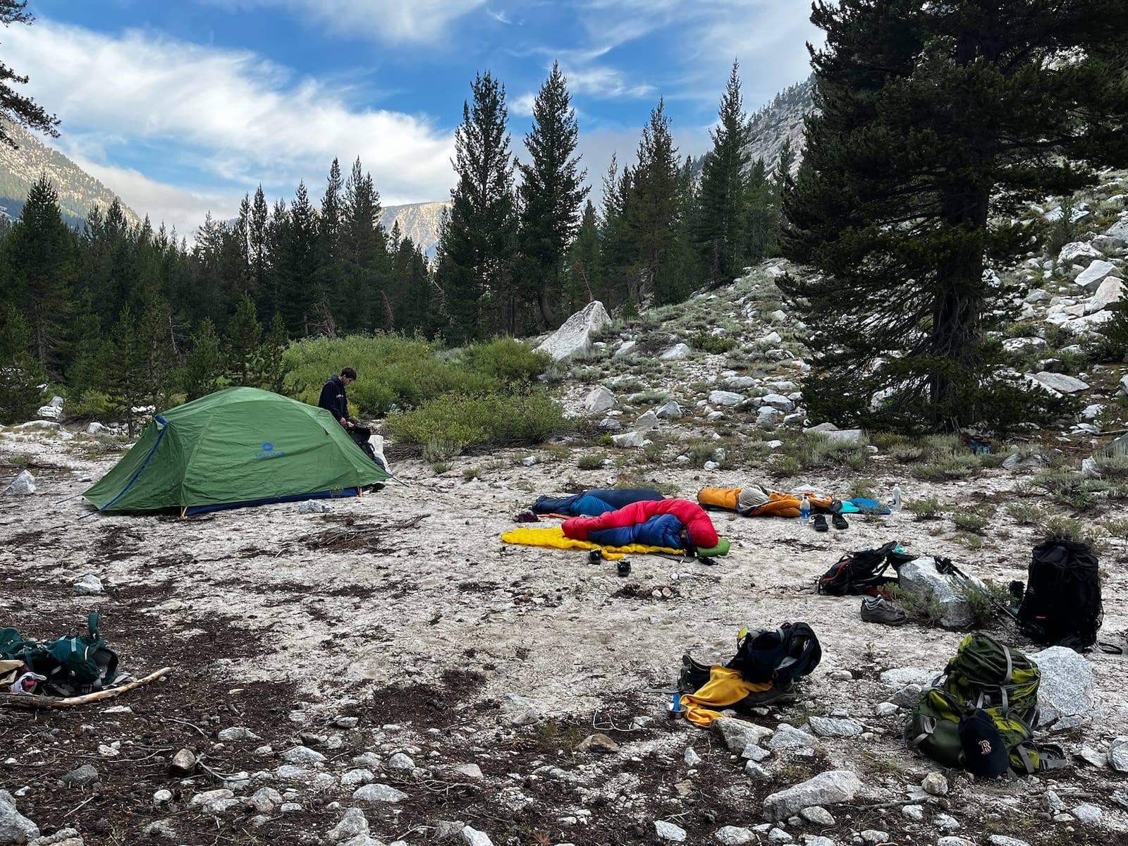
After lunch, we crossed the creek and turned up into the Second Recess, where the going got steeper and the trail became patchier. Originally, our plan had been to make it all the way to Lower Mills Creek Lake for our first night's camp. But as it was getting later in the day, we opted to save the final move up to the lake for the next morning. Instead, we camped at a nice sandy spot with an established fire ring, just at the upper end of the Mills Creek meadow.
Day 2: Mills Creek to Lake Italy
~6 miles, +3000', -1000'
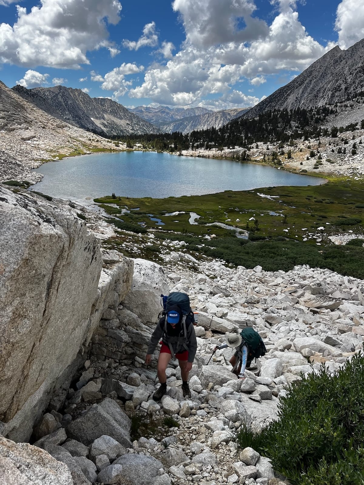
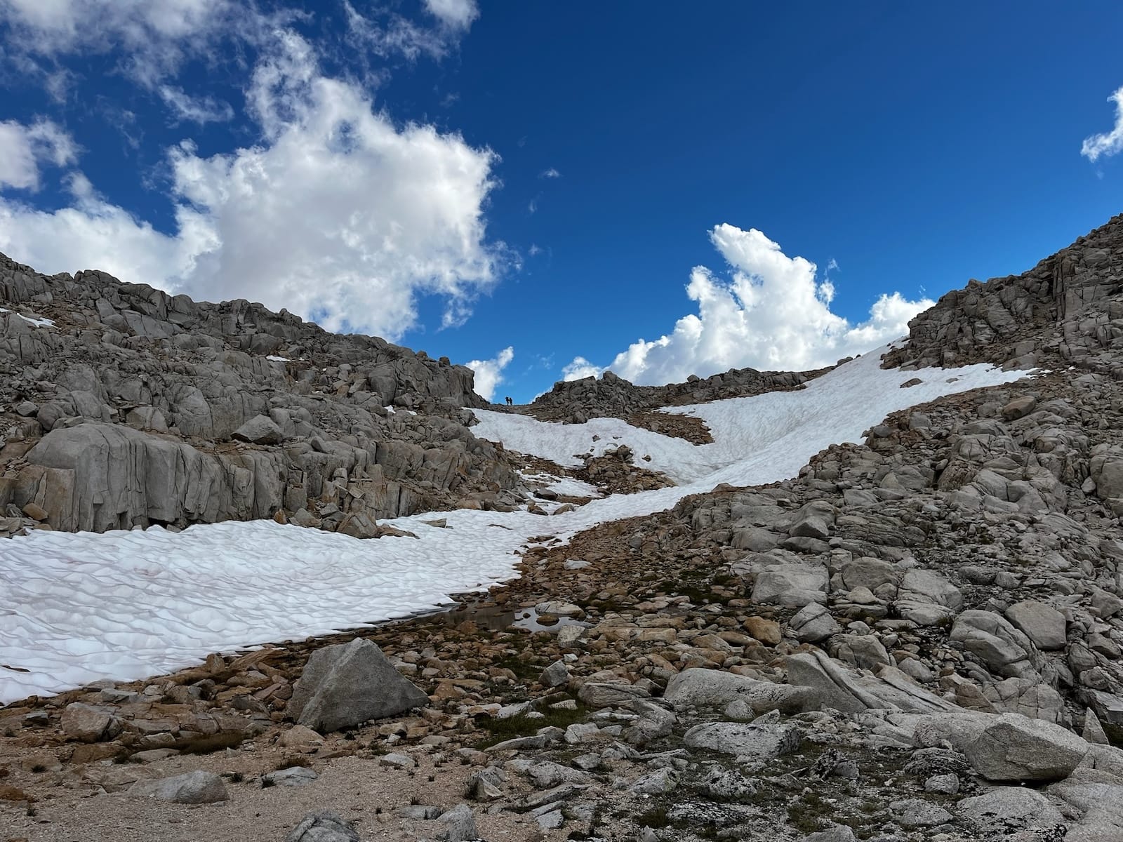
Although shorter than Day 1 by a couple miles, Day 2 felt much tougher given the steep incline and the frictions of (mostly) off-trail navigation, especially below the tree line. The first stretch, from camp up to Lower Mills Creek Lake, was a particular challenge due to low visibility and the narrow shape of the drainage. It's easy to get caught either on steep boulder-laden inclines away from the creek, or in the dense tangle of brush closer to the creek itself. We managed to walk a fine line between the two, preferring areas with granite slab underfoot, and made it to the lake in time for a lunch break before continuing up toward Gabbot Pass.
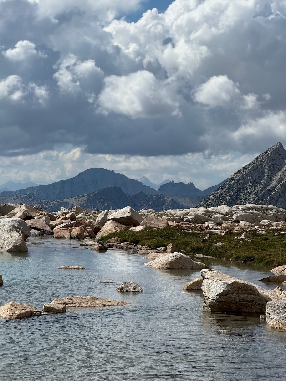
The visibility really opened up after this point, and although several of us were feeling the altitude, we were consoled by views of the Banner-Ritter saddle (30 miles away) framed by a deep-blue pool, and some late-July snow fields just below the pass.
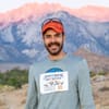
After topping out around 12,250', the next basin opened up with majestic views of the Bear Creek Spires and Mt. Julius Caesar (see this post's cover image), not to mention the twin giants of Mt. Abbot and Mt. Gab (is Gabbot Pass really just a combination of the two names?), both of which reach heights of over 13,700'. After the day's exertions, we descended eagerly to Toe Lake where we found a solid campsite among some large boulders, with commanding views of the basin and surrounding peaks.
Day 3: Lake Italy to Sandpiper Lake
~11 miles, +1600', -2200'
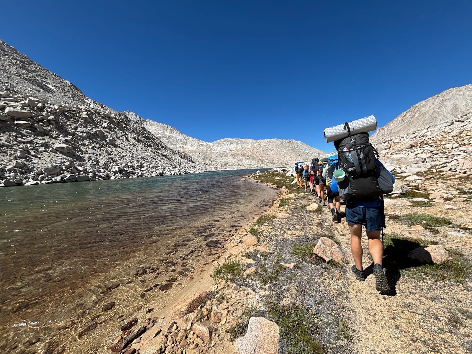
The plan for Day 3 was to follow the Hilgard Branch of Bear Creek back down the the JMT/PCT, and then turn south and head up toward Selden Pass. We started with a nice easy walk along the shores of Lake Italy, with expansive views of Italy Pass and the Silver Divide as we turned down to begin following the Hilgard Branch. But our cross-country challenges weren't over; the drainage got steeper and the brush got thicker as we descended, especially where the (mostly patchy) trail climbed along canyon edges to avoid the snarls and marshiness of the creek.
Note: The USGS Quad Sheet shows a trail beginning at Lake Italy on the north/east side of the creek that would follow a steeper course, but which seemed a bit riskier for a larger group with varying experience levels. We found it easier to stay on the south/west side of the creek for a while (following a shallow incline on exposed granite) and then make a crossing once the opposite side had leveled out.
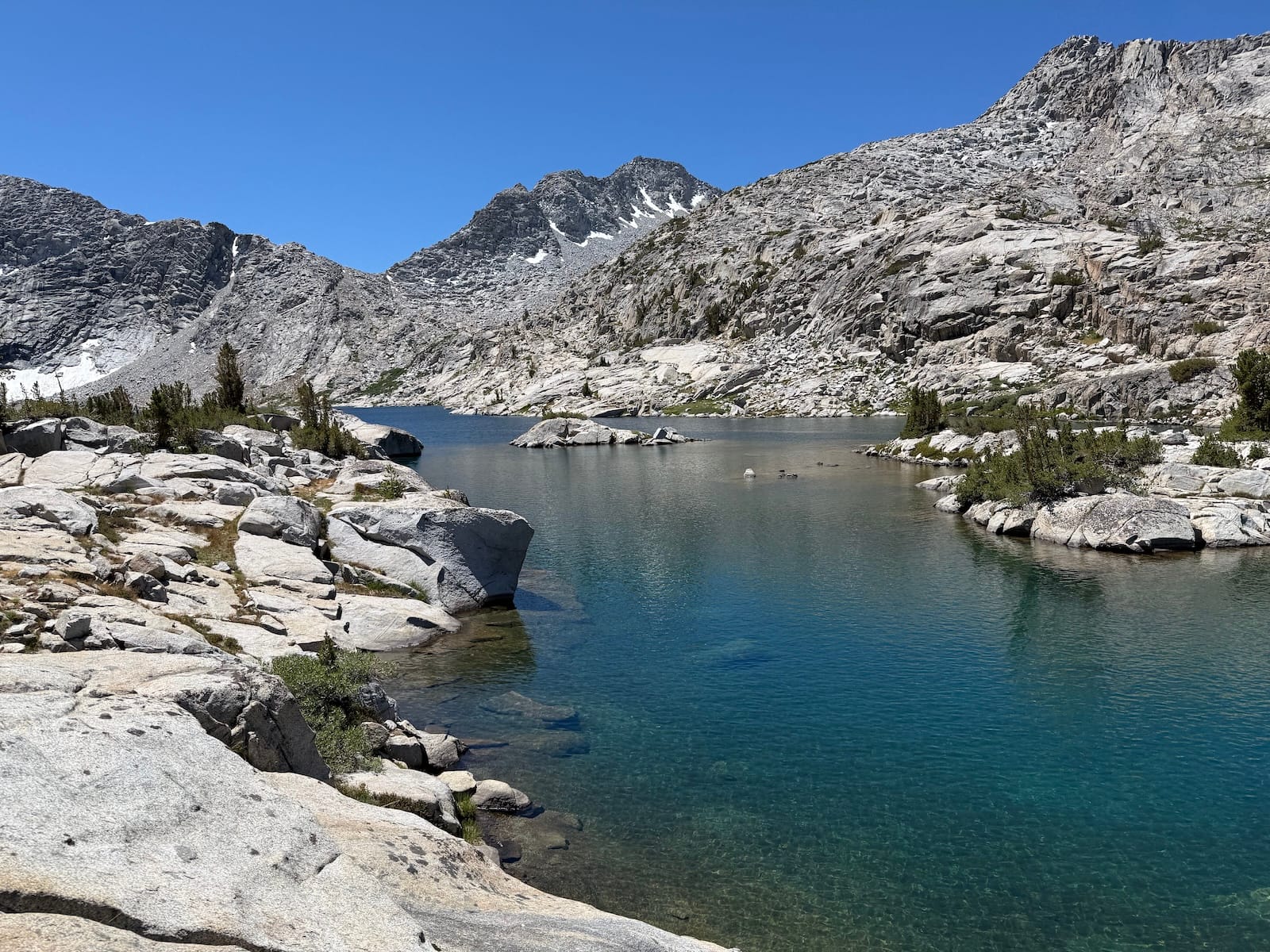
Once we'd rejoined the JMT/PCT, the walking was easy up to the lovely Sandpiper Lake. Just a couple miles off the beaten path, Sandpiper is a little gem bordered by soft granite ledges, a series of alpine ponds, and a hilly peninsula reminiscent of Evolution Lake. That night, the group enjoyed stargazing under crystal clear skies.
Day 4: Sandpiper Lake to Rose Lake
~4 miles, +600' -700'
After the intensity of roughly 10,000 feet of total elevation change, including off-trail navigation, we'd planned for Day 4 to be a shorter hiking day, and we enjoyed taking our time! After some much needed extra sleep, some folks stayed at camp to do laundry, while others walked over to the opposite side of Sandpiper Lake to swim and sunbathe.
Bonus: Three Island Lake
Meanwhile, I was curious about Medley and Three Island Lakes, so I trekked further up the drainage with lunch and a daypack. These did not disappoint! Medley is a fairy-tale collection of small lakes in a maze of granite, where Three Island is a much larger lake pushed up against the tall stuff at the top of the basin. Together with Sandpiper, this area would make for a great weekend trek or fishing trip. Check out the map of my lunch hike on Garmin Connect.
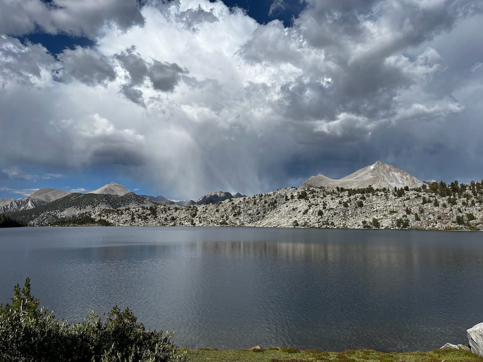
After a leisurely lunch, we finally packed up and made our day's move over to Rose Lake, another side-basin on the opposite side of the JMT/PCT. In late afternoon, while some of us made camp on a tree-shaded hill on the lake's near side, others circumnavigated the lake and captured photos of a gorgeous storm system moving in from the north. The weather ended up skirting us completely!
Day 5: Rose Lake to Edison Dam
~13 miles, +1000', -3800'
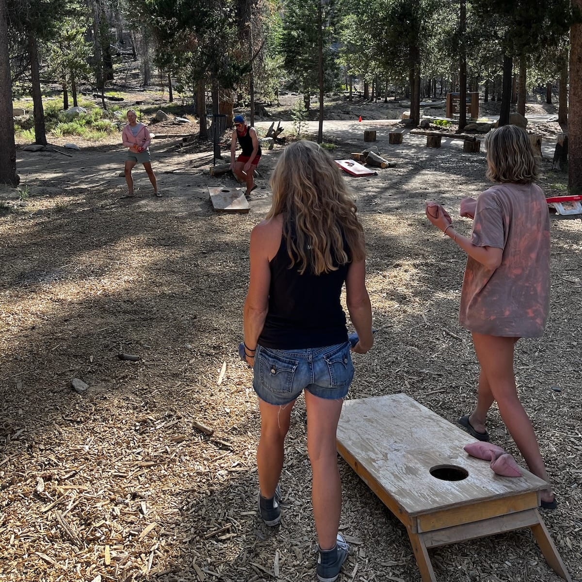
The final day was our longest mileage, but it was mostly all downhill on established trails back to the Edison Lake dam, where we'd stashed a couple of cars. We got up early, moved quickly, and arrived back to Vermilion Valley Resort around 2pm, with time to wash up and enjoy some rest and relaxation (including some rousing games of cornhole!), before a delectable dinner of chicken parmesan. It was a pleasure to once again experience VVR's legendary wilderness hospitality as a weary (and ravenous) hiker.
All told, this was an incredible trip. It's a testament to the area's diverse wilderness that we were able to plot a course that satisfied all of our goals: seeing new territory, adventuring safely off-trail with a larger group, and reserving time to appreciate the stunning lakes, passes, peaks, and basins that make this particular slice of backcountry so special.
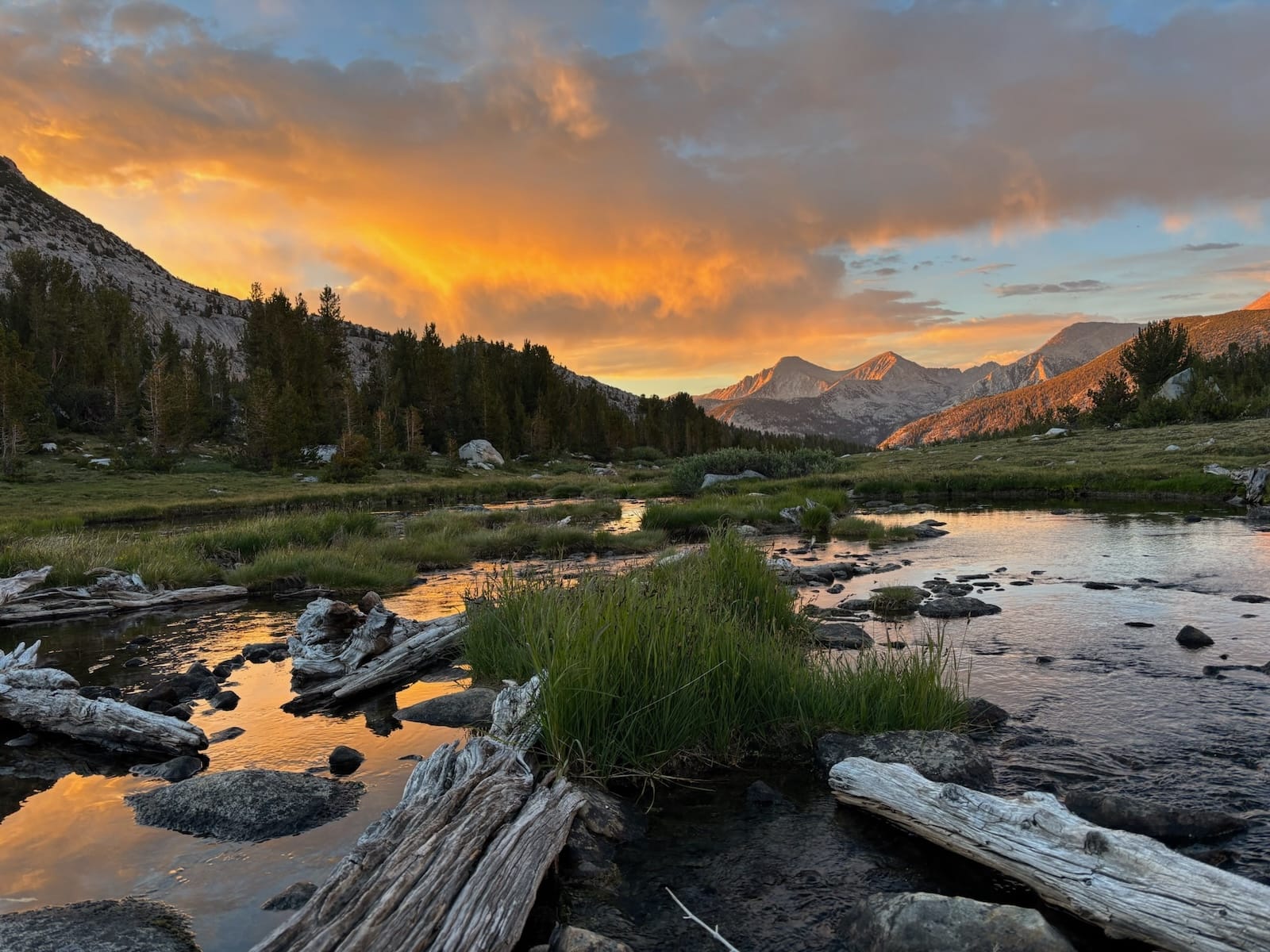
I'll leave you with a parting photo of Recess and Mist Peaks via Rose Lake—both of which are visible from VVR—seen here from a new angle, but illuminated by a typically dazzling sunset.